12380
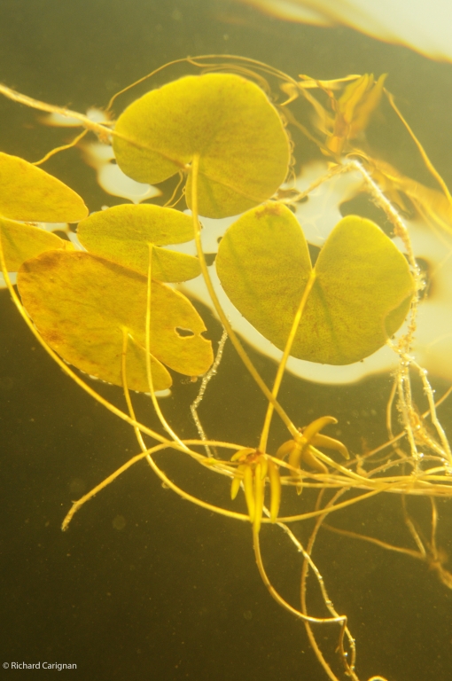
 Nymphoides cordata, Faux-nymphea a feuilles cordees, aout 2009
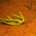
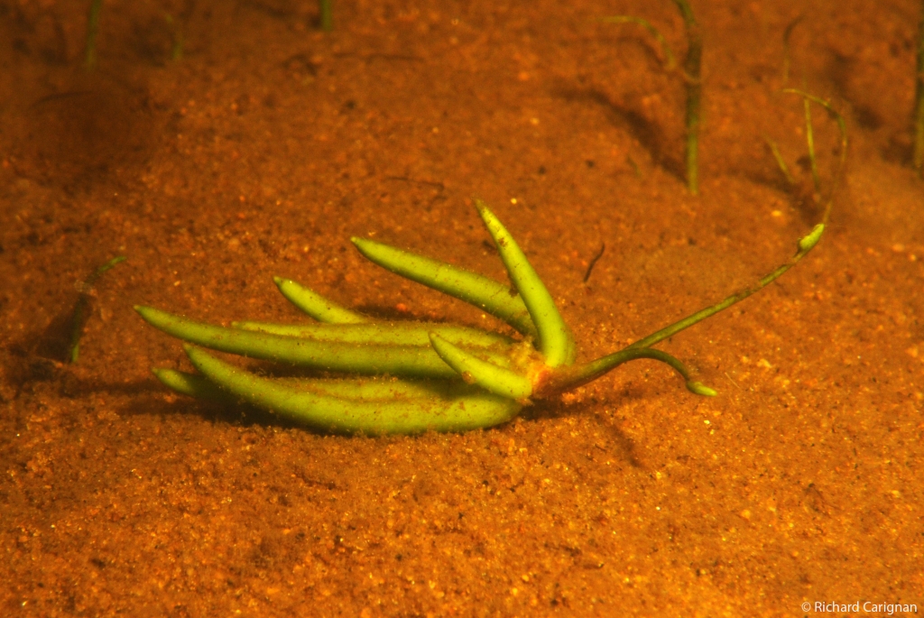
, aout 2009") Nymphoides cordata, Faux-nymphea a feuilles cordees (propagule), aout 2009
Nymphoides cordata, Faux-nymphea a feuilles cordees (propagule), aout 2009
 Lac Escalier, Juillet 2014
 Lac Escalier, Juillet 2014
 Lac Escalier, Juillet 2014
 Lac Escalier, Juillet 2014
 Lac Escalier, Juillet 2014
 Lac Escalier, Juillet 2014

Lac Escalier
Description du lac et du bassin versant
Identification
- Nom du lac : Escalier
- Coordonnées géographiques : 46°25'15"N -74°27'45"O
- Numéro RSVL :
- MRC:
Les Laurentides - Municipalité:
Lac-Supérieur
-
OBV:
Organisme de bassins versants des rivières Rouge, Petite Nation et Saumon
Données morphométriques et hydrologiques
- Superficie du lac: km²
- Volume du lac: m³
- Profondeur maximale: m
- Profondeur moyenne: m
- Altitude: m
- Superficie du bassin versant incluant les lacs: km²
- Temps de renouvellement: 0,00 année
- Ratio de drainage: 0.00
- Profondeur maximale de croissance des macrophytes:
- Pourcentage du fond du lac colonisable par les macrophytes:
Règlements, politiques et usages
- Municipalité Lac-Supérieur: Règlements
- Municipalité Lac-Supérieur: Environnement
- MRC Les Laurentides: Règlements
- MRC Les Laurentides: Environnement
Études et rapports
Vie associative
Photos
 Nymphoides cordata, Faux-nymphea a feuilles cordees, aout 2009
, aout 2009") Nymphoides cordata, Faux-nymphea a feuilles cordees (propagule), aout 2009
Nymphoides cordata, Faux-nymphea a feuilles cordees (propagule), aout 2009
 Lac Escalier, Juillet 2014
 Lac Escalier, Juillet 2014
 Lac Escalier, Juillet 2014
 Lac Escalier, Juillet 2014
 Lac Escalier, Juillet 2014
 Lac Escalier, Juillet 2014
Cartes
Il n'y a pas d'autre carte associée à ce lac pour l'instant
Références et outils
- Groupe de recherche interuniversitaire en limnologie – GRIL
-
Ministère de l’Environnement, de la Lutte contre les changements climatiques, de la Faune et des Parcs- MELCCFP
- Direction régionale (Montréal, Laval, Lanaudière et Laurentides) : https://www.quebec.ca/gouvernement/ministere/environnement/coordonnees/adresses-des-directions-regionales/
- Réseau de surveillance volontaire des lacs : https://www.environnement.gouv.qc.ca/eau/rsvl/
- Section rivières et lacs : https://www.environnement.gouv.qc.ca/eau/flrivlac/riv-lac.htm
- Urgence Environnement : https://www.environnement.gouv.qc.ca/ministere/rejoindr/urgence.htm
-
Publications et outils du CRE Laurentides
- Section Eau- Lacs : https://crelaurentides.org/documentation/#Eau